
Most real estate professionals spend years hunting deals by property type, price range, and condition. What they skip is why location data transforms deal finding more than any other variable. Geographic intelligence, the recognized industry term for this discipline, means layering behavioral, demographic, and spatial signals on top of a property address. Without it, you are pricing and prioritizing deals based on a fraction of the picture. This article breaks down how location data works, why it beats gut instinct in competitive markets, and exactly how to integrate it into your daily workflow.
Table of Contents
- Key Takeaways
- Why location data transforms deal finding
- How location context improves deal selection
- Data quality and geographic consistency
- Geographic ROI metrics and social proof
- Applying location data to your daily workflow
- My honest take on location data in real estate
- Find better deals with Wholesalehq
- FAQ
Key Takeaways
| Point | Details |
|---|---|
| Location data beats property data alone | Geographic context like foot traffic and demographics predicts deal value better than square footage or condition alone. |
| Data quality is non-negotiable | Fragmented or inconsistent geo identifiers cause AI tools to misprioritize good assets and surface bad ones. |
| Foot traffic is a live demand signal | Footfall trends surface market momentum weeks before price changes appear in transaction records. |
| Geographic ROI metrics sharpen budgets | Metrics like Geo-CAC and Territory LTV tell you which markets deserve your capital and which do not. |
| Parcel-level data reduces false positives | Starting your candidate universe at the parcel level with enriched boundary data cuts time wasted on weak leads. |
Why location data transforms deal finding
You already know that location matters in real estate. What most investors, agents, and wholesalers miss is how granular geographic data changes every stage of the deal process, from sourcing to pricing to closing. This is not about zip codes and school ratings. Geographic intelligence pulls in trade areas, competitor proximity, foot traffic patterns, cross-shopping behavior, labor market accessibility, and projected population growth. Each of those layers replaces a guess with a data point.
Here is what that looks like in practice. A wholesaler targeting distressed single-family homes in a mid-size city might rank two neighborhoods identically by price-to-ARV ratio. But one neighborhood sits within half a mile of a new mixed-use development attracting retail and foot traffic, while the other is seeing population decline and retail vacancies. Location data surfaces that difference before you tie up capital. Traditional analysis would not.
The types of location data most relevant to real estate deal finding include:
- Foot traffic and visitation trends from mobile device data and GPS signals
- Demographic and population growth projections at the census tract and parcel level
- Proximity data covering distance to amenities, employers, transit, and competing assets
- Public records enrichment including permit history, mortgage activity, and boundary membership
- Behavioral data such as cross-shopping patterns that indicate neighborhood demand trajectory
Pro Tip: Do not rely solely on county assessor data for geographic context. Combine it with mobile-derived foot traffic and permit records to get a complete demand picture for any target area.
How location context improves deal selection
The shift from guesswork to market-context layers is where geographic intelligence creates its biggest advantage. Replacing guesswork with market context means you are not asking "is this a good deal?" in isolation. You are asking "is this a good deal given what foot traffic, demographics, and competitive supply tell me about this specific block?"
Foot traffic deserves special attention here. Most real estate metrics are lagging indicators. Transaction prices, days on market, and absorption rates tell you what happened weeks or months ago. Foot traffic is different. Footfall data acts as a live demand proxy, surfacing market momentum before slower price and transaction signals catch up. If visitation to a retail corridor near your target property is trending up sharply, that is a leading indicator of demand pressure that will eventually show up in prices.
Consider the speed at which markets move. In February 2026, 18.5% of homes nationally went pending within seven days. In the fastest markets, more than a third of homes went pending under a week, and those listings were 2.6 times more likely to sell above asking price. If you are waiting for traditional market reports to tell you which submarkets are heating up, you are already behind.
Granular foot traffic data adds behavioral layers that provide predictive insight not captured by traditional property metrics. That predictive layer is what separates investors who close deals at the right price from those who overpay or miss the window entirely.
Predictive analytics built on location-based behavioral data allow you to model demand trajectory, not just current conditions. An agent working buyer relocations, for example, can use labor market accessibility scores to show a client exactly how many employers are within a commutable range of a target neighborhood. That is a closing argument with numbers behind it.
Data quality and geographic consistency
Here is where most teams quietly fail. The benefits of location intelligence disappear if your underlying data is fragmented, inconsistently labeled, or running on mismatched geographic identifiers. This problem is more common than professionals admit.

The specific failure point is usually the geographic join. When your CRM, your property database, and your foot traffic data all use slightly different address formats or boundary definitions, the joins break. Address ambiguity and inconsistent geo keys cause broken rollups where properties fall into the wrong territory or disappear from aggregated views entirely. The downstream effect is that your analytics show the wrong markets as opportunities.
Building reliable location data workflows requires a structured approach:
- Establish a parcel-level candidate universe. Start every deal search with precise parcel boundaries, not just street addresses. Enrich each parcel with permits, mortgage records, and boundary memberships to reduce false positives from the start.
- Invest in a geo-hierarchy and crosswalk layer. This ensures consistent mapping of territories, census tracts, and custom boundaries across your internal tools and any external datasets you pull in. Geo hierarchy and crosswalk layers prevent broken rollups when you aggregate across markets.
- Apply data provenance tracking. Know where every location record came from, when it was last validated, and which identifier system it uses. Data provenance and unified location IDs are critical to preventing AI-driven tools from misprioritizing good assets due to conflicting location information.
- Normalize before you analyze. Data transformation and normalization is not optional. Raw location records from different sources need cleaning and standardization before they can produce trustworthy outputs at scale.
Pro Tip: When evaluating any location data vendor, ask specifically how they handle address disambiguation and what geographic identifier system they use. Vendors who cannot answer that question clearly will create data quality problems downstream.
The impact of poor data quality is not just inaccurate reports. It means AI-powered deal discovery tools deprioritize good assets because location-based targeting with approximate signals causes the algorithm to lose confidence in a property's classification.
Geographic ROI metrics and social proof
Once your data is clean, location analytics becomes a sales and resource allocation tool, not just a sourcing tool. Two capabilities stand out here: geographic ROI measurement and location-based social proof.
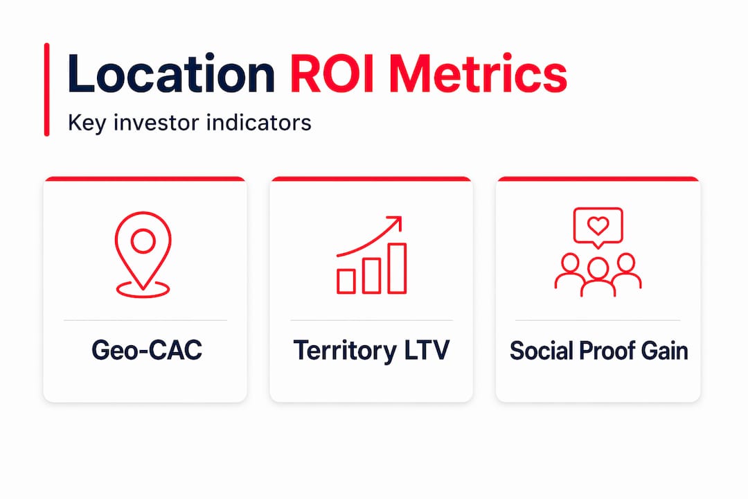
On the measurement side, standard ROI metrics treat all markets as equivalent. Geo-CAC and Territory LTV give you cost per customer acquisition and lifetime value calculated at the geographic territory level. Spatial conversion rate tells you which markets close at a higher rate per contact. These metrics let you redirect budget from saturated, expensive markets into territories where your dollar produces more deals.
| Metric | What it measures | Why it matters for deal finding |
|---|---|---|
| Geo-CAC | Customer acquisition cost by territory | Identifies markets where outreach costs less per closed deal |
| Territory LTV | Lifetime value of deals closed in a region | Shows which markets generate repeat business and referrals |
| Spatial conversion rate | Lead-to-close rate by geography | Flags markets where your pitch lands better |
On the social proof side, proximity matters more than most professionals realize. Location-based social proof increases conversion likelihood significantly, with proximity-scoped references increasing desired behavior by 33%. Referral-based leads convert at 14.7% versus 8.5% for social media leads. When you are presenting an off-market opportunity to a seller or a deal to a cash buyer, citing a comparable transaction on the same block carries more persuasive weight than a county-wide comp.
Applying location data to your daily workflow
Knowing the theory is one thing. Building it into how you actually find deals is where the returns show up.
Start by building a parcel-level candidate universe for every target market. Pull in permits, mortgage data, and ownership history, then enrich each record with boundary memberships so you know which school district, census tract, and custom territory each parcel belongs to. This structure lets you filter and rank candidates using any location layer you add later.
From there, adopt an authoritative location identity system. Whether you use a commercial geo-identifier or build your own crosswalk, make sure every data source in your stack maps to the same identifier. This is the single change that makes AI-driven discovery tools actually work reliably. Pair that with regular foot traffic monitoring for your target submarkets. When visitation trends shift, that is your cue to act before the broader market catches up.
Pro Tip: Set up automated foot traffic alerts for the corridors and submarkets you track most actively. A 20% month-over-month uptick in visitation near a target property is worth responding to faster than any price movement will tell you to.
Combining location intelligence with traditional market data, like absorption rates, days on market, and seller motivation scores, gives you a layered view no single source provides. Wholesalehq is built specifically around this kind of multi-signal approach, combining motivation scoring, cash transaction density, and competitor analysis to surface deals before they hit saturated pipelines.
My honest take on location data in real estate
I have watched a lot of real estate teams adopt data tools with high expectations and land in frustration six months later. The problem almost never comes down to bad data sources. It comes down to trusting data that was never properly unified.
I have seen investors confidently act on "location analytics" that was actually address-level foot traffic joined to county-level demographic data with no crosswalk between them. The result was a map that looked authoritative and was almost entirely wrong. The deals they passed on were the ones they should have taken, and vice versa.
What I have learned is that geographic intelligence is only as good as the identity layer underneath it. Before you invest in any location data product or start pulling foot traffic reports, get your geo-hierarchy sorted out. Know which identifier your property database uses, how it maps to census boundaries, and how your CRM handles address normalization. That foundational work feels unglamorous, but it is what separates teams that genuinely gain an edge from teams that just have better-looking dashboards.
For professionals just starting to integrate location data: pick one use case, foot traffic trend monitoring for a single target submarket, for example, and get it working cleanly end to end before adding more layers. Complexity is not the goal. Accuracy is.
— Zach
Find better deals with Wholesalehq
If reading this made you realize your current workflow is missing geographic depth, that is exactly the problem Wholesalehq was built to solve.

Wholesalehq combines motivation scoring, cash transaction density, and competitor density analysis into a single platform so you can identify leads in unsaturated markets before the competition finds them. The platform calculates MAO and ARV automatically, so you spend less time building spreadsheets and more time making offers. If you are a wholesaler, investor, or agent tired of chasing the same deals everyone else is working, Wholesalehq gives you the geographic and behavioral context to find the ones they are missing.
FAQ
What is geographic intelligence in real estate?
Geographic intelligence is the practice of layering behavioral, demographic, and spatial data onto property records to improve deal selection, pricing, and timing decisions. It goes well beyond zip code analysis to include foot traffic, competitor proximity, and population growth projections.
How does foot traffic data improve deal finding?
Foot traffic acts as a live demand proxy, surfacing market momentum weeks before price changes appear in transaction records. Monitoring visitation trends in target submarkets helps investors act on demand signals before the broader market prices them in.
Why does data quality matter for location-based analytics?
Poor geographic data quality, typically caused by inconsistent identifiers and address ambiguity, causes AI-driven tools to misprioritize assets and produce broken rollups. Unified location IDs and data provenance tracking are required to produce reliable outputs.
What are Geo-CAC and Territory LTV?
Geo-CAC measures your customer acquisition cost at the territory level, while Territory LTV calculates the lifetime deal value generated within a specific geographic market. Together, these metrics show which markets deserve more outreach budget and which are overinvested.
How do I start using location data in my deal workflow?
Build a parcel-level candidate universe first, enriched with permits, mortgage records, and boundary memberships. Then add a single location layer, such as foot traffic trends, before expanding to demographics and competitive density. Accuracy at each stage matters more than breadth.